place

William Thomas State Forest

Geography of New HampshireMerrimack County, New HampshireNew Hampshire geography stubsNew Hampshire state forestsNortheastern United States protected area stubs
Protected areas of Merrimack County, New Hampshire

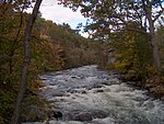
William Thomas State Forest is a 1,660-acre (670 ha) state forest in the town of Hill, New Hampshire, in the United States. It is named for Harvard University class of 1945 graduate and B-24 Liberator pilot William H. Thomas Jr. who used his discharge pay to acquire 60 wooded acres and subsequently expanded his holdings to about 1,700. He had visions of a resort development, but retreated to the area in 1987 and donated the lands to the state of New Hanpshire when he died in 2001. The area reportedly has some double track but no single track trails.

Excerpt from the Wikipedia article William Thomas State Forest (License: CC BY-SA 3.0, Authors).

William Thomas State Forest
State Route 3A,

Geographical coordinates (GPS) Address Nearby Places
placeShow on map

Wikipedia: William Thomas State ForestContinue reading on Wikipedia

Geographical coordinates (GPS)

Latitude Longitude
N 43.545555555556 ° E -71.733055555556 °
placeShow on map

Address

State Route 3A

State Route 3A
03243
New Hampshire, United States
mapOpen on Google Maps

Share experience

Nearby Places

Central Square Historic District (Bristol, New Hampshire)

The Central Square Historic District of Bristol, New Hampshire, encompasses the central commercial district of the town. The square is a four-sided space near the junction of six roadways in the center of Bristol, just north of the Newfound River and west of the Pemigewasset River. The district includes all of the buildings that are arrayed around the square, as well as one contemporary commercial building located just south of the Newfound River on South Main Street. The district was listed on the National Register of Historic Places in 1983.The center of Bristol began to take shape in the 1760s with the arrival of the first non-Native settlers. A road was cut along the Pemigewasset River, which crossed the Newfound River near where South Main Street does today. A mill was built a little way to the east. By the 1790s a small town center had emerged, including two tavern buildings that still stand. A new road (now North Main Street) to Newfound Lake in 1805 further enhanced the area's importance as a transportation junction, shortly followed by what is now Pleasant Street in 1808. How the square itself formed is uncertain, since there are no formal town documents discussing the matter.The center grew in the 19th century with the arrival of industrial mills and the railroad. Most of the municipal functions were located away from the square, which developed as a commercial business district. Early surviving instances of wood frame commercial construction include in the 1841 Bean-Tukey Block and the 1848 Cass Block. The west side of the square was subjected to destructive fires in 1861 and 1871, resulting in the construction of Victorian brick blocks on that side of the square. The square's basic structures today are, with only few exceptions, what they were in the late 19th century.

Murray Hill Summer Home District

The Murray Hill Summer Home District is a collection of farmhouses and related buildings on Murray Hill Road, a rural road in Hill, New Hampshire. The area is distinctive as a cohesive collection of rural properties that were adapted for use as summer estates between 1873 and 1937, the start date representing an early transition from agricultural to tourist use of such properties in the state. The district has eight farmhouses that were adapted, and two Shingle style houses, as well as one 19th-century district schoolhouse that has been repurposed as a meeting space. All are located on Murray Hill Road between Cass Mill Road and Lynch (Dickerson Hill) Road. The district was listed on the National Register of Historic Places in 1988.Murray Hill Road, located in northwestern Hill, very roughly follows a terrace at an elevation of about 1,000 feet (300 m) on the north side of a ridge whose peaks are Page and Dickinson Hills (elevations 1,600 feet (490 m) and 1,800 feet (550 m) respectively). Remnants of the area's agricultural past survive in the form of abandoned roads and farm tracks, and stone walls which line fields and wooded areas. In 1873 John Murdock began buying up land in the area, which he subdivided for the development of summer houses. Land was typically transferred between family members and friends. By the time the state was involved in organized attempts to adapt abandoned farms for the summer tourist trade, the Murray Hill area had for the most part already been transformed. One typical property is the Chandler property, which includes a farmhouse built c. 1810, and operated primarily as a farm until 1878. The owners then began taking in summer boarders to supplement declining farm income. The Chandlers acquired the property in 1927, and began a series of modifications to adapt it as a summer property.