place

Ragged Mountain (New Hampshire)

Andover, New HampshireDanbury, New HampshireMountains of Merrimack County, New HampshireMountains of New Hampshire
RaggedMountainNH
RaggedMountainNH

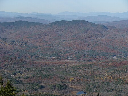
Ragged Mountain (2,286 feet (697 m) above sea level) is a low mountain with numerous knobby summits in the towns of Danbury and Andover in central New Hampshire. It is home to the Ragged Mountain ski resort.

Excerpt from the Wikipedia article Ragged Mountain (New Hampshire) (License: CC BY-SA 3.0, Authors, Images).

Ragged Mountain (New Hampshire)
SRK Greenway,

Geographical coordinates (GPS) Address Nearby Places
placeShow on map

Wikipedia: Ragged Mountain (New Hampshire)Continue reading on Wikipedia

Geographical coordinates (GPS)

Latitude Longitude
N 43.468055555556 ° E -71.829444444444 °
placeShow on map

Address

SRK Greenway

SRK Greenway
03216
New Hampshire, United States
mapOpen on Google Maps

RaggedMountainNH
RaggedMountainNH
Share experience

Nearby Places

Hopkins Pond (New Hampshire)

Hopkins Pond (also known as Adder Pond) is a small pond located at the south foot of Ragged Mountain, in the town of Andover, New Hampshire, United States. It lies at an elevation of 644 feet (196 m). The pond is part of Proctor Academy's 2,500-acre (10 km2) campus in Andover and is jointly managed by Proctor and the New Hampshire Fish and Game Department. The pond area is open to the public for non-motorized boat travel, fishing and hiking. This shallow pond has an average depth of 6 feet (1.8 m), is 15 feet (4.6 m) deep at the deepest point, and covers a total area of 27 acres (11 ha). It empties eastward into Mountain Brook below Elbow Pond. Mountain Brook, in turn, is a tributary of the Blackwater River, which flows via the Contoocook River and Merrimack River to the Gulf of Maine (Atlantic Ocean) at Newburyport, Massachusetts. Hopkins Pond sits within the Merrimack River watershed, and is floristically considered part of the Sunapee Uplands sub-region of the Lower New England-Northern Piedmont Ecoregion, as defined by The Nature Conservancy, and the New England-Acadian Forest Ecoregion, as defined by the World Wildlife Fund.The north shore of Hopkins Pond can be accessed from the west by Middle Hopkins Pond Trail. The south shore can be accessed from Lower Hopkins Pond Trail. Both shores can be accessed from the east by an NH Fish and Game access road off Elbow Pond Road. Observed species of fish in the pond include rainbow trout and brook trout.

Murray Hill Summer Home District

The Murray Hill Summer Home District is a collection of farmhouses and related buildings on Murray Hill Road, a rural road in Hill, New Hampshire. The area is distinctive as a cohesive collection of rural properties that were adapted for use as summer estates between 1873 and 1937, the start date representing an early transition from agricultural to tourist use of such properties in the state. The district has eight farmhouses that were adapted, and two Shingle style houses, as well as one 19th-century district schoolhouse that has been repurposed as a meeting space. All are located on Murray Hill Road between Cass Mill Road and Lynch (Dickerson Hill) Road. The district was listed on the National Register of Historic Places in 1988.Murray Hill Road, located in northwestern Hill, very roughly follows a terrace at an elevation of about 1,000 feet (300 m) on the north side of a ridge whose peaks are Page and Dickinson Hills (elevations 1,600 feet (490 m) and 1,800 feet (550 m) respectively). Remnants of the area's agricultural past survive in the form of abandoned roads and farm tracks, and stone walls which line fields and wooded areas. In 1873 John Murdock began buying up land in the area, which he subdivided for the development of summer houses. Land was typically transferred between family members and friends. By the time the state was involved in organized attempts to adapt abandoned farms for the summer tourist trade, the Murray Hill area had for the most part already been transformed. One typical property is the Chandler property, which includes a farmhouse built c. 1810, and operated primarily as a farm until 1878. The owners then began taking in summer boarders to supplement declining farm income. The Chandlers acquired the property in 1927, and began a series of modifications to adapt it as a summer property.