Barford, Hampshire
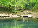
Barford is a scattered hamlet in the civil parish of Headley in the East Hampshire district of Hampshire, England. The village lies on the Hampshire-Surrey border, approximately 2 miles (3.2 km) from Hindhead. Its nearest town is Bordon, which lies approximately 3.6 miles (5.8 km) south-west from the village. The stream which marks the parish and county boundary once had three mills, all now private dwellings. Two were involved in paper-making, and one corn-grinding. The oldest is mentioned in a pipe-roll of 1264 while the others date from the 18th century. One of the paper mills was subsequently used for flock, and one housed French prisoners of war during the Napoleonic Wars.Barford bridge, formerly a dangerous ford, was built across the stream in the early 1900s.
Excerpt from the Wikipedia article Barford, Hampshire (License: CC BY-SA 3.0, Authors).Barford, Hampshire
BW32, Waverley
Geographical coordinates (GPS) Address Nearby Places Show on map
Geographical coordinates (GPS)
| Latitude | Longitude |
|---|---|
| N 51.128953 ° | E -0.782433 ° |
Address
BW32
BW32
GU26 6JD Waverley
England, United Kingdom
Open on Google Maps


