Bramshott Common
Geography of HampshireHampshire geography stubs
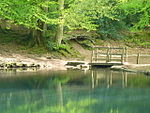
Bramshott Common is part of a large expanse of heathland, including Ludshott Common, near Bramshott, Hampshire, England.It was the site of Bramshott Camps, set up to accommodate Canadian troops during the two world wars. It is bisected by the A3 trunk road.
Excerpt from the Wikipedia article Bramshott Common (License: CC BY-SA 3.0, Authors).Bramshott Common
Portsmouth Road, East Hampshire Bramshott and Liphook
Geographical coordinates (GPS) Address External links Nearby Places Show on map
Geographical coordinates (GPS)
| Latitude | Longitude |
|---|---|
| N 51.095555555556 ° | E -0.77138888888889 ° |
Address
Bramshott Common
Portsmouth Road
GU30 7SZ East Hampshire, Bramshott and Liphook
England, United Kingdom
Open on Google Maps


