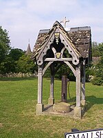
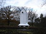
Newdigate
Civil parishes in SurreyMole ValleyUse British English from February 2013Villages in Surrey

Newdigate is a village and civil parish in the Mole Valley borough of Surrey lying in a relatively flat part of the Weald to the east of the A24 road between Dorking and Horsham, 13 miles (21 km) ESE of Guildford and 25 miles (40 km) south of London. Neighbouring parishes are Charlwood, North Holmwood, South Holmwood, Leigh and Capel.
Excerpt from the Wikipedia article Newdigate (License: CC BY-SA 3.0, Authors, Images).Newdigate
Parkgate Road, Mole Valley Newdigate
Geographical coordinates (GPS) Address Nearby Places Show on map
Geographical coordinates (GPS)
| Latitude | Longitude |
|---|---|
| N 51.1786 ° | E -0.2782 ° |
Address
Parkgate Road
Parkgate Road
RH5 5DZ Mole Valley, Newdigate
England, United Kingdom
Open on Google Maps


