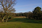
Leigh, Surrey
Civil parishes in SurreyEngvarB from July 2016Mole ValleyVillages in Surrey

Leigh is a village and civil parish in Surrey, between Reigate, Dorking and Charlwood in the east of Mole Valley district. The village centre is suburban and its remainder is agricultural, interspersed by four satellite clustered localities: Dawesgreen, Bunce Common, Shellwood Cross and Nalderswood which benefit from the amenities of the village and a minority of the remainder is woodland.
Excerpt from the Wikipedia article Leigh, Surrey (License: CC BY-SA 3.0, Authors, Images).Leigh, Surrey
Bunce Common Road, Mole Valley Leigh
Geographical coordinates (GPS) Address Nearby Places Show on map
Geographical coordinates (GPS)
| Latitude | Longitude |
|---|---|
| N 51.21 ° | E -0.258 ° |
Address
Bunce Common Road
Bunce Common Road
RH2 8NP Mole Valley, Leigh
England, United Kingdom
Open on Google Maps


