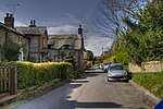
Kitwood
Villages in Hampshire

Kitwood is a hamlet in the parish of Four Marks, Hampshire, England. It is in the south east of the Parish and has been part of Four Marks since its creation in 1932. Prior to this, it was part of Ropley Parish. Although the settlement was located at the junction of Kitwood road and Swelling, as is visible in older maps, the settlement now spreads all the way from Swelling hill pond to Kitwood farm near Hawthorn Road.
Excerpt from the Wikipedia article Kitwood (License: CC BY-SA 3.0, Authors, Images).Kitwood
Gradwell Lane, East Hampshire Four Marks
Geographical coordinates (GPS) Address Nearby Places Show on map
Geographical coordinates (GPS)
| Latitude | Longitude |
|---|---|
| N 51.1 ° | E -1.05 ° |
Address
Gradwell Lane
Gradwell Lane
GU34 5AS East Hampshire, Four Marks
England, United Kingdom
Open on Google Maps


