Four Marks
EngvarB from October 2023Quadripoints and higherVillages in Hampshire

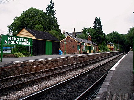
Four Marks is a village and civil parish in the East Hampshire district of Hampshire, England. It is 4.4 miles (7.1 km) southwest of Alton, on the A31 road. It is situated on the borders of the South Downs National Park on the Pilgrims' Way that leads from Winchester to Canterbury. It contains within it the medieval hamlets of Kitwood, Hawthorn and Lymington, although now the whole parish is relatively closely settled.
Excerpt from the Wikipedia article Four Marks (License: CC BY-SA 3.0, Authors, Images).Four Marks
Hazel Road, East Hampshire Four Marks
Geographical coordinates (GPS) Address Nearby Places Show on map
Geographical coordinates (GPS)
| Latitude | Longitude |
|---|---|
| N 51.111 ° | E -1.044 ° |
Address
Hazel Road
GU34 5EX East Hampshire, Four Marks
England, United Kingdom
Open on Google Maps


