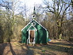
Ropley

Ropley is a village and large civil parish in the East Hampshire district of Hampshire, England. It has an acreage of 4,684 acres (1,896 ha), situated 4 miles (6.4 km) east from New Alresford, and is served by a station on the Mid Hants Railway heritage line at Ropley Dean, just over 1 mile (1.6 km) from the village shops. It is 6.7 miles (10.8 km) southwest of Alton, just off the A31 road. It lies within the diocese of Winchester. The St Swithun's Way, part of the Pilgrims' Way from Winchester to Canterbury, passes through the village. It is distinguished by its general absence of pavements in favour of boundary walls, hedges and mature trees. Ropley holds an annual Boxing Day walk, and a pram race on the spring bank holiday in May.
Excerpt from the Wikipedia article Ropley (License: CC BY-SA 3.0, Authors, Images).Ropley
Hörlkofener Straße, Hörlkofen (VGem)
Geographical coordinates (GPS) Address Nearby Places Show on map
Geographical coordinates (GPS)
| Latitude | Longitude |
|---|---|
| N 51.08305 ° | E -1.07855 ° |
Address
Hörlkofener Straße 10a,10b,10c
85457 Hörlkofen (VGem)
Bayern, Deutschland
Open on Google Maps


