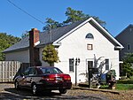
Byberry, Philadelphia
Byberry is a neighborhood in the far northeast section of Philadelphia, in the U.S. state of Pennsylvania. Originally it was incorporated as the Township of Byberry and was the northeasternmost municipality of Philadelphia County before the City and County were consolidated in 1854. Its approximate boundaries are the Poquessing Creek to the north, Woodhaven Road to the south, the Roosevelt Boulevard to the west, and Thornton Road to the east. Byberry had a strong abolitionist presence and may have been an original stop on the Underground Railroad. Today, the area occupied by the township is mostly synonymous with the neighborhood of Somerton, as the neighborhoods of Byberry and Somerton tend to overlap.
Excerpt from the Wikipedia article Byberry, Philadelphia (License: CC BY-SA 3.0, Authors).Byberry, Philadelphia
Kenny Road, Philadelphia
Geographical coordinates (GPS) Address Nearby Places Show on map
Geographical coordinates (GPS)
| Latitude | Longitude |
|---|---|
| N 40.1 ° | E -74.968 ° |
Address
Kenny Road 12789
19154 Philadelphia
Pennsylvania, United States
Open on Google Maps


