place

Normandy, Philadelphia

Neighborhoods in PhiladelphiaNortheast PhiladelphiaPhiladelphia stubs

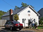
Normandy is a neighborhood in Northeast Philadelphia. It is located east of Roosevelt Boulevard, in the vicinity of Woodhaven and Byberry Roads, built in 1955- 1956. All of the streets in this neighborhood begin with the letter N. The neighborhood is made up of Cape Cod-style single-family homes, with frame construction. Most of the homes have received additions over the years. The original landowners were Joseph Buckman, who owned 73 acres (300,000 m2) and John Rieger, who owned 18 acres (73,000 m2). The old Nabisco/Mondelez International plant at the southwest corner of Roosevelt Boulevard and Byberry Road was demolished in 2017-2018 to pave way for a present Wawa. Provco Group who owns the real estate is in the process of building a Topgolf facility and is proposing a pair of strip mall-style buildings and a standalone restaurant along Roosevelt Boulevard. Those would be adjacent to the Wawa, which opened near Byberry Road as part of the first phase of the redevelopment of the site.. Devon Self-Storage occupies what used to be Best products, also what was the original Normandy Square market.The Northeast Village was a wartime military housing project just south of the present Normandy Village.

Excerpt from the Wikipedia article Normandy, Philadelphia (License: CC BY-SA 3.0, Authors).

Normandy, Philadelphia
Franklin Mills Boulevard, Philadelphia

Geographical coordinates (GPS) Address Nearby Places
placeShow on map

Wikipedia: Normandy, PhiladelphiaContinue reading on Wikipedia

Geographical coordinates (GPS)

Latitude Longitude
N 40.084 ° E -74.966 °
placeShow on map

Address

Franklin Mills Boulevard 34
19154 Philadelphia
Pennsylvania, United States
mapOpen on Google Maps

Share experience

Nearby Places

Andalusia, Pennsylvania

Andalusia is a historic neighborhood and unincorporated community in Bensalem Township, Bucks County, Pennsylvania, bordering Philadelphia along the Poquessing Creek. The ZIP Code is 19020. The area is the southernmost part of the township and of the county. Its boundaries are: Woodhaven Road (Pennsylvania Route 63) to the northeast, the Delaware River to the east and south, and Poquessing Creek to the north and west. Interstate 95 runs through its southeastern section near the Delaware River. The neighborhood takes its name from Andalusia, the estate of Philadelphia financier Nicholas Biddle (1786–1844), now preserved as a National Historic Landmark.In 1922, the unincorporated village was named Torresdale Manor, after the neighboring Torresdale section of Philadelphia, and some developments in the area are still associated with that name. Today, Andalusia is a middle class suburb, mainly typical of the area. Many of its grid-style streets contain small single-family homes that date back to the 1920s. Andalusia is also home to many historic buildings, some dating back to the early nineteenth century, owned and inhabited by some of Philadelphia's wealthiest families. Architectural styles include Gothic Revival, Romanesque, and Greek Revival. The neighborhood's main thoroughfare, Bristol Pike (US Route 13, formerly King's Highway), reveals various homes and churches that have been preserved, while the most esteemed buildings, including Biddle's estate, the Pen Ryn mansion, and State in Schuylkill, are hidden along the banks of the Delaware. Saint Katharine Drexel is buried at the Katharine Drexel Shrine, which is also in the area on Bristol Pike. The Red Lion Inn was located here, at the Red Lion Bridge, along King's Highway (Bristol Pike), at the Poquessing Creek. The area contains several shopping areas and abuts the Philadelphia Mills mall. The neighborhood students attend the Bensalem Township School District. The NBC pilot episode for Outlaw, starring Jimmy Smits filmed here March 22–23, 2010.Rita's Water Ice opened their first store in the area.