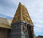
Canning Vale, Western Australia
Canning Vale, Western AustraliaSuburbs in the City of CanningSuburbs in the City of GosnellsSuburbs of Perth, Western AustraliaUse Australian English from March 2014

Canning Vale is a southern suburb of Perth, 22 km (13.7 mi) from the central business district. Its local government areas are the City of Canning (west of Nicholson Road) and the City of Gosnells (east of Nicholson Road).
Excerpt from the Wikipedia article Canning Vale, Western Australia (License: CC BY-SA 3.0, Authors, Images).Canning Vale, Western Australia
Eucalyptus Boulevard, City Of Canning
Geographical coordinates (GPS) Address Nearby Places Show on map
Geographical coordinates (GPS)
| Latitude | Longitude |
|---|---|
| N -32.0813818 ° | E 115.916882 ° |
Address
Eucalyptus Boulevard
Eucalyptus Boulevard
6155 City Of Canning, Canning Vale
Western Australia, Australia
Open on Google Maps


