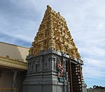
Harrisdale, Western Australia
Harrisdale is a southeastern suburb of Perth, Western Australia and is one of the western suburbs of the City of Armadale. It was gazetted in 2007, and has a population of 9,076 as of the 2016 Australian census. The population of the developing area is expected to grow to over 10,000 by 2031.On 12 April 2008, a joint venture was announced between the Government of Western Australia and Cedar Woods Properties Limited to develop a 30-hectare (74-acre) site in the northwest of the suburb of Harrisdale with an emphasis on affordable housing and sustainable living. The development, known as Harrisdale Green, commenced construction in July 2010 and will accommodate up to 500 homes.The suburb is bounded by Warton Road to the northwest, Ranford Road to the northeast, Skeet Road to the southeast and Nicholson Road to the southwest.Carey Baptist College is a co-educational school that occupies a 12-hectare (30-acre) site in Harrisdale. It was established by the Carey Community Baptist Church in 1998 and provides education from kindergarten through to Year 12.Harrisdale Senior High School is a public high school in Harrisdale that opened in 2017. The Harrisdale Swamp Bushland occupies a significant portion of the suburb's west. It is a banksia woodland dominated by Banksia attenuata and Banksia menziesii. The mammal species Quenda occurs in this area.
Excerpt from the Wikipedia article Harrisdale, Western Australia (License: CC BY-SA 3.0, Authors).Harrisdale, Western Australia
Wright Road, City Of Armadale
Geographical coordinates (GPS) Address Nearby Places Show on map
Geographical coordinates (GPS)
| Latitude | Longitude |
|---|---|
| N -32.112 ° | E 115.932 ° |
Address
Wright Road 108
6110 City Of Armadale, Harrisdale
Western Australia, Australia
Open on Google Maps


