Palmietfontein Airport
Airports in JohannesburgDefunct airportsHistory of GermistonHistory of South AfricaPages with non-numeric formatnum arguments ... and 1 more
Use South African English from April 2013
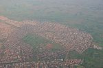
Palmietfontein Airport (Afrikaans: Palmietfontein Lughawe) was an airport situated to the south of Johannesburg (Katlehong), South Africa, from 1945 to 1952. Latitude: -26° 20' 7.20" S Longitude: 28° 08' 28.80" E
Excerpt from the Wikipedia article Palmietfontein Airport (License: CC BY-SA 3.0, Authors).Palmietfontein Airport
Simelani Street,
Geographical coordinates (GPS) Address Nearby Places Show on map
Geographical coordinates (GPS)
| Latitude | Longitude |
|---|---|
| N -26.336666666667 ° | E 28.146666666667 ° |
Address
Simelani Street
Simelani Street
1651 , Ncala
Gauteng, South Africa
Open on Google Maps


