Vosloorus
Populated places established in 1963Populated places in EkurhuleniTownships in Gauteng

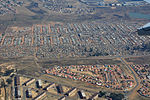
Vosloorus is a large township situated south of Boksburg and just east of Katlehong in Ekurhuleni, just 30 kilometres south-east of Johannesburg, Gauteng, South Africa. It was established in 1963 when Black Africans were removed from Stirtonville because it was considered by the government too close to a white town. Stirtonville, renamed Reiger Park, has since become home to Boksburg's coloured community. A local authority was established in 1983 when Vosloorus was given full municipal status.
Excerpt from the Wikipedia article Vosloorus (License: CC BY-SA 3.0, Authors, Images).Vosloorus
Douglas Montseng Drive,
Geographical coordinates (GPS) Address Nearby Places Show on map
Geographical coordinates (GPS)
| Latitude | Longitude |
|---|---|
| N -26.358333333333 ° | E 28.2075 ° |
Address
Douglas Montseng Drive
Douglas Montseng Drive
1475 , Vosloorus
Gauteng, South Africa
Open on Google Maps


