place

Paracuellos de Jarama

Air traffic control in SpainMadrid geography stubsMunicipalities in the Community of Madrid
Paracuellos de Jarama

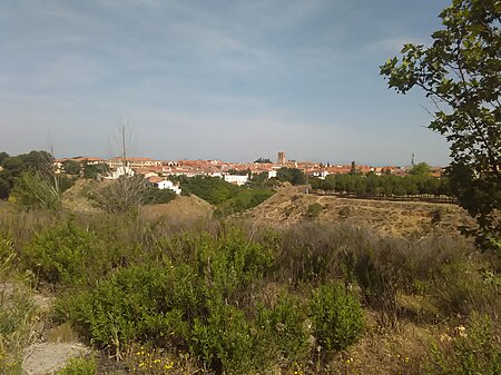
Paracuellos del Jarama is a small town and municipality in the Community of Madrid, Spain. It is located northeast from Madrid and very close to Madrid-Barajas Airport. The etymology of the name is unclear.In 1936, it (along with Torrejón de Ardoz) was the site of the Paracuellos massacres.

Excerpt from the Wikipedia article Paracuellos de Jarama (License: CC BY-SA 3.0, Authors, Images).

Geographical coordinates (GPS)

Latitude Longitude
N 40.55 ° E -3.51667 °
placeShow on map

Address

Tomar de Tripas


28863
Community of Madrid, Spain
mapOpen on Google Maps

Paracuellos de Jarama
Share experience

Nearby Places

Daganzo de Arriba
Daganzo de Arriba

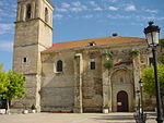
Daganzo de Arriba is a Spanish municipality in the Comarca de Alcalá, located in the east of Autonomous Community of Madrid. It has a population of about 9,000 (including the residents of the permanent camping that is in the town), of which are mostly young families, in more recent times people have been purchasing homes in the new housing subdivisions that are being built and residing within those new neighborhoods. It is 27 km to the east-northeast of Madrid and 11 km to the north of Alcalá de Henares. It has an altitude of 673 meters above sea level and has a municipal area of 4,325 hectares. The village is surrounded by small hills. From north to south, the river Torote runs through the village, in whose margins was located the first settlement of this town, in the same place where the church of Nuestra Señora del Espino is, and stream Valseco. There are two industrial parks which collectively employ about 1,800 workers, of which 800 are residents of the town. The rest come from other nearby municipalities. It has an important agriculture according to the area of the municipality, which is quite extensive and of acceptable quality. The climate that dominates the area is characterized by very high summer temperatures and low winter temperatures. Rainfall in summer is almost zero and medium in periods of autumn and winter, therefore is unevenly distributed throughout the year. The average annual temperature is 14.5 °C with temperatures ranging from 27 °C in summer to 5 °C in winter.
Madrid–Barajas Airport

Adolfo Suárez Madrid–Barajas Airport (IATA: MAD, ICAO: LEMD), commonly known as Madrid–Barajas Airport, is the main international airport serving Madrid, the capital city of Spain. At 3,050 ha (7,500 acres) in area, it is the second-largest airport in Europe by physical size behind Paris–Charles de Gaulle Airport. In 2019, 61.8 million passengers travelled through Madrid–Barajas, making it the country's busiest airport as well as Europe's fifth-busiest. The airport opened in 1931 and has grown to be one of Europe's most important aviation centres. Within the city limits of Madrid, it is 9 km (6 mi) from the city's financial district and 13 km (8 mi) northeast of the Puerta del Sol or Plaza Mayor de Madrid, Madrid's historic centre. The airport name derives from the adjacent district of Barajas, which has its own metro station on the same rail line serving the airport. Barajas serves as the gateway to the Iberian peninsula from the rest of Europe and the world and is a key link between Europe and Latin America. Following the death of former Spanish Prime Minister, Adolfo Suárez, in 2014, the Spanish Ministry of Public Works and Transport announced that the airport was to be renamed Aeropuerto Adolfo Suárez, Madrid–Barajas. The airport is the primary hub and maintenance base for Iberia and Air Europa. Consequently, Iberia is responsible for more than 40% of Barajas's traffic. The airport has five passenger terminals: T1, T2, T3, T4 and T4S.