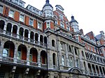
Paddington Basin

Paddington Basin is the name given to a long canal basin, and its surrounding area, in Paddington, London. The basin commences 500 m south of the junction known as Little Venice, of the Regent's Canal and the Paddington Arm of the Grand Union Canal and runs for a similar length east–west. It was opened in 1801, with Paddington being chosen as the site of the basin because of its position on the New Road which led to the east, providing for onward transport. In its heyday, the basin was a major transshipment facility, and a hive of activity. Since 2000, the basin has been the centre of a major redevelopment as part of the wider Paddington Waterside scheme and is surrounded by modern buildings.
Excerpt from the Wikipedia article Paddington Basin (License: CC BY-SA 3.0, Authors, Images).Paddington Basin
South Wharf Road, London Paddington
Geographical coordinates (GPS) Address Nearby Places Show on map
Geographical coordinates (GPS)
| Latitude | Longitude |
|---|---|
| N 51.518 ° | E -0.174 ° |
Address
The Queen Mother Wing (Queen Elizabeth Wing;St. Marys A&E and Heart Attack Treatment Centre)
South Wharf Road
W2 1BL London, Paddington
England, United Kingdom
Open on Google Maps


