Binnel Bay
Bays of the Isle of WightUse British English from June 2015

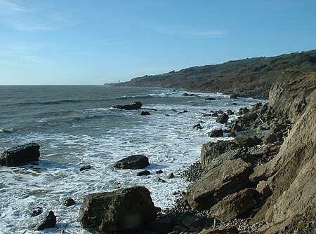
Binnel Bay is a bay on the south coast of the Isle of Wight, England. It lies between the villages of St. Lawrence and Niton. It faces south towards the English Channel, and is just under one mile (1.6 km) in length. It stretches from Binnel Point in the east to Puckaster Cove in the west. The bay is remote with a rocky and exposed shoreline backed by low cliffs and woodlands. It is best viewed from Binnel Point, where the bay can be seen stretching west towards Puckaster Cove, with St Catherine's Lighthouse visible in the distance. Large sections of a now destroyed 19th century seawall can be seen along the shore.
Excerpt from the Wikipedia article Binnel Bay (License: CC BY-SA 3.0, Authors, Images).Binnel Bay
Undercliff Drive,
Geographical coordinates (GPS) Address Nearby Places Show on map
Geographical coordinates (GPS)
| Latitude | Longitude |
|---|---|
| N 50.5787 ° | E -1.2711 ° |
Address
Undercliff Drive
Undercliff Drive
PO38 1XY , Niton and Whitwell
England, United Kingdom
Open on Google Maps


