Reeth Bay
Bays of the Isle of WightUse British English from June 2015

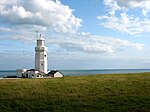
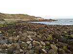
Reeth Bay is a small curved bay on the southernmost tip of the Isle of Wight, England. It lies to the south of the village of Niton with a 1⁄4-mile-long (0.4 km) shoreline. It faces south out into the English Channel and lies to the east of St. Catherine's Point lighthouse. It is at the centre of a small hamlet called Castlehaven where there is a concrete ramp for launching small craft. The beach is predominantly sand and pebbles. The seabed is a mixture of rocks and mud. The bay is best accessed from the road from Niton that leads down to the bay.
Excerpt from the Wikipedia article Reeth Bay (License: CC BY-SA 3.0, Authors, Images).Reeth Bay
Undercliff Drive,
Geographical coordinates (GPS) Address Nearby Places Show on map
Geographical coordinates (GPS)
| Latitude | Longitude |
|---|---|
| N 50.58 ° | E -1.28 ° |
Address
Undercliff Drive
Undercliff Drive
PO38 2LX , Niton and Whitwell
England, United Kingdom
Open on Google Maps


