place

St Catherine's Point

Headlands of the Isle of WightNature Conservation Review sites
St catherines lighthouse 2010

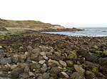
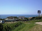
St Catherine's Point is the southernmost point on the Isle of Wight. It is close to the village of Niton and the point where the Back of the Wight changes to the Undercliff of Ventnor. On nearby St Catherine's Down is St Catherine's Oratory, locally known as the "Pepperpot", a stone lighthouse built in the 1323 by Walter De Godeton. It is Britain's oldest medieval lighthouse.Reportedly, de Godeton felt guilty for having scavenged wine, destined for a monastery from the wreck of the St Marie of Bayonne in Chale Bay. He was ordered, on pain of excommunication, to make amends by building this lighthouse. Fires were lit in the lighthouse tower to warn ships at sea of the presence of the coast. There was an attached chapel at one time, but it has been long demolished. There is a Bronze Age barrow nearby which was excavated in the 1920s. A replacement lighthouse was begun in 1785. However it was never completed. Locally this half-finished building is known as the "salt pot". St Catherine's point is often foggy, so it is not the best location for a lighthouse, but as a weather station the location is fairly suitable. The weather station is one of the 22 locations whose reports are included in the BBC Shipping Forecast. LB&SCR H1 class 4-4-2 no. 40 (later no. B40 and 2040) was named St. Catherine's Point after this landmark.

Excerpt from the Wikipedia article St Catherine's Point (License: CC BY-SA 3.0, Authors, Images).

St Catherine's Point
Sandrock Road,

Geographical coordinates (GPS) Address Nearby Places
placeShow on map

Wikipedia: St Catherine's PointContinue reading on Wikipedia

Geographical coordinates (GPS)

Latitude Longitude
N 50.575 ° E -1.2955555555556 °
placeShow on map

Address

St. Catherine's Lighthouse (Niton Lighthouse)

Sandrock Road
PO38 2NG , Niton and Whitwell
England, United Kingdom
mapOpen on Google Maps

St catherines lighthouse 2010
Share experience

Nearby Places

St. Catherine's Down

St. Catherine's Down is a chalk down on the Isle of Wight, located near St Catherine's Point, the southernmost point on the island. The Down rises to 240 metres at its highest point, between the towns of Niton and Chale. Upon the hill is St. Catherine's Oratory (known locally as "the pepperpot"), which is a stone lighthouse built in the 14th century by Walter De Godeton. It is the second oldest, and only surviving, medieval lighthouse in the British Islands: only the Roman lighthouse at Dover is older. Reportedly, de Godeton was found guilty for having plundered wine that belonged to the Church from the shipwreck of the St. Marie of Bayonne in Chale Bay. He was ordered to make amends, under threat of excommunication, by building and maintaining the lighthouse. It was completed after his death, and staffed by a priest; fires were lit in the tower to warn ships of the coast. There was originally a chapel attached, which has since been demolished. A Bronze Age barrow near the Oratory was excavated in the 1920s. A replacement lighthouse was begun in 1785 but was never completed because the Down is prone to dense fog. Locally, the surviving foundations are known as the "salt cellar". After the wreck of the Clarendon in 1837, a new lighthouse, St Catherine's Lighthouse, was built to the west of Niton at the foot of the Undercliff. The River Medina, the main river of the Isle of Wight, rises at St Catherine's Down and flows northwards through the county town Newport, towards the Solent at Cowes.