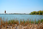
Brooklin, Ontario
Brooklin is a community in the town of Whitby, Ontario, Canada, north of central Whitby, at the south junction of Ontario Highways 12 and 7. While the area of Brooklin proper is confined to a specific area, the general area surrounding Brooklin largely identifies as "Brooklin" rather than "Whitby". Brooklin was located primarily in rural area about two decades ago, but it is now part of the urban Whitby, with high population growth and infrastructure development. Brooklin is surrounded with hills covering the north and the west. The hills and the forests that dominate the north are part of the South Slope of the Oak Ridges Moraine. It is located within the Lynde Creek Watershed which retains 19 to 26% of its forest cover. The population has grown rapidly since the early 1990s, with the addition of thousands of homes, predominately subdivisions, surrounding the heart of Brooklin.
Excerpt from the Wikipedia article Brooklin, Ontario (License: CC BY-SA 3.0, Authors).Brooklin, Ontario
Pearl Street, Whitby Brooklin
Geographical coordinates (GPS) Address Nearby Places Show on map
Geographical coordinates (GPS)
| Latitude | Longitude |
|---|---|
| N 43.958333333333 ° | E -78.959722222222 ° |
Address
Pearl Street
Pearl Street
L1M 1A2 Whitby, Brooklin
Ontario, Canada
Open on Google Maps


