place

Linthicum Heights Historic District

1908 establishments in MarylandAnne Arundel County, Maryland Registered Historic Place stubsHistoric districts in Anne Arundel County, MarylandHistoric districts on the National Register of Historic Places in MarylandLinthicum, Maryland
NRHP infobox with nocatNational Register of Historic Places in Anne Arundel County, MarylandUse mdy dates from August 2023
Linthicum Heights Historic District View 1 Dec 09

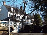
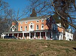
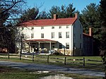
Linthicum Heights Historic District is a national historic district at Linthicum Heights, Anne Arundel County, Maryland. It consists of a suburban community surrounding the intersection of Camp Meade Road (MD 170) and Maple Road. The community is situated on a series of low hills about three miles south of the Patapsco River and includes 17 tree-shaded streets created originally as a planned railroad suburb on the lines connecting Baltimore, Annapolis, and Washington, beginning in 1908. The district consists of 254 contributing resources, including two churches, a cemetery, and a former commercial/residential building. Most of the housing was built prior to 1939 and include examples of the Bungalow, American Foursquare, Colonial Revival, Dutch Revival, and Tudor Revival styles.It was listed on the National Register of Historic Places in 2006.

Excerpt from the Wikipedia article Linthicum Heights Historic District (License: CC BY-SA 3.0, Authors, Images).

Linthicum Heights Historic District
Sweetser Road,

Geographical coordinates (GPS) Address Nearby Places
placeShow on map

Wikipedia: Linthicum Heights Historic DistrictContinue reading on Wikipedia

Geographical coordinates (GPS)

Latitude Longitude
N 39.206111111111 ° E -76.654722222222 °
placeShow on map

Address

Sweetser Road 127
21090
Maryland, United States
mapOpen on Google Maps

Linthicum Heights Historic District View 1 Dec 09
Share experience

Nearby Places

Linthicum station
Linthicum station

Linthicum station is a Baltimore Light Rail station in Linthicum Heights, Maryland. This station is the last station on the light rail's trunk line; southbound trains depart onto branches to BWI Marshall Airport station and Cromwell station. There is currently no free public parking or bus connections at this station.Linthicum station uses a railroad line formerly served by the Baltimore and Annapolis Railroad. It is accessible from a long crosswalk across from the intersection of Camp Meade Road (MD 170) and Benton Avenue, and the Linthicum Volunteer Fire Company (Station #32). Another crosswalk to the station leads to Oakdale Road on the opposite side of the tracks. The station reopened again in 1993, and the spur to Marshall Airport was created in 1997. Ridership at the station averages 372 people daily, 67% of whom are transfers to either BWI Airport or Cromwell station. Only 33% of riders are "walk-ups" from the surrounding neighborhood, according to a 2011-2012 study funded by the MTA.There is an effort to close this station due to the crime the station is alleged to bring to its community, including an attempted murder. While MTA has not considered closing the station, other actions have been taken or considered. These include the placement of a call box where riders can alert police when in need, additional security cameras, and the early closing of the station at 8 pm. Early attempts to have this stop closed date back to 1994.