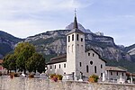
Dent de Crolles
Caves of Auvergne-Rhône-AlpesMountains of IsèreMountains of the AlpsPages with French IPATwo-thousanders of France

The Dent de Crolles (French pronunciation: [dɑ̃ də kʁɔl]) is a karstic mountain (2,062 m) of the Chartreuse Mountains range, 17 kilometres (11 miles) north east of Grenoble, Isère, France. It has a characteristic "tooth-like" profile and is easily recognizable in the Isère Valley (Grésivaudan) in the Grenoble area. The French word "dent" means tooth and "de Crolles" is derived from the town of Crolles, located next to the mountain.
Excerpt from the Wikipedia article Dent de Crolles (License: CC BY-SA 3.0, Authors, Images).Dent de Crolles
Sangle de la Face Est, Grenoble
Geographical coordinates (GPS) Address Nearby Places Show on map
Geographical coordinates (GPS)
| Latitude | Longitude |
|---|---|
| N 45.308333333333 ° | E 5.8552777777778 ° |
Address
Sangle de la Face Est
38380 Grenoble
Auvergne-Rhône-Alpes, France
Open on Google Maps


