Crolles
Communes of IsèreIsère geography stubsPages with French IPA

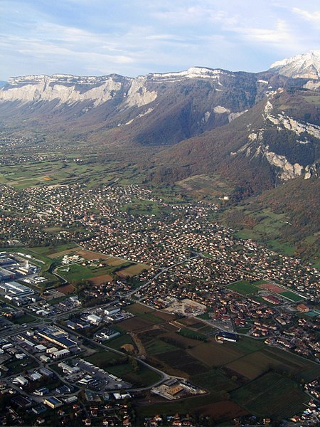
Crolles (French pronunciation: [kʁɔl]) is a commune in the Isère department in southeastern France. It is located in the Isère valley, 20 km northeast of Grenoble, upstream on the river Isère. It has given its name to the Dent de Crolles mountain (2,062 m), which stands just above the city.
Excerpt from the Wikipedia article Crolles (License: CC BY-SA 3.0, Authors, Images).Crolles
Rue du 11 Novembre 1918, Grenoble
Geographical coordinates (GPS) Address Phone number Website Nearby Places Show on map
Geographical coordinates (GPS)
| Latitude | Longitude |
|---|---|
| N 45.2858 ° | E 5.8836 ° |
Address
Pharmacie Luu Duc
Rue du 11 Novembre 1918 2
38920 Grenoble
Auvergne-Rhône-Alpes, France
Open on Google Maps


