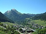
Lac de Montriond
Haute-Savoie geography stubsLakes of Haute-Savoie

Lac de Montriond is a lake at Montriond in the Haute-Savoie department of France. It has a surface area of 32 ha. There is a circular path around the lake and several restaurants next to the D228 access road (which connects Montriond to Les Lindarets). In Winter the lake surface frequently freezes over and the immediate area surrounding the lake experiences extremes of cold due to the topology of the surrounding area blocking most sunlight during the coldest months of Winter.
Excerpt from the Wikipedia article Lac de Montriond (License: CC BY-SA 3.0, Authors, Images).Lac de Montriond
Route Forestière du Lac, Thonon-les-Bains
Geographical coordinates (GPS) Address Nearby Places Show on map
Geographical coordinates (GPS)
| Latitude | Longitude |
|---|---|
| N 46.208333333333 ° | E 6.7277777777778 ° |
Address
Route Forestière du Lac
Route Forestière du Lac
74110 Thonon-les-Bains
Auvergne-Rhône-Alpes, France
Open on Google Maps


