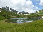
Hauts-Forts
Haute-Savoie geography stubsMountains of Haute-SavoieMountains of the Alps

The Hauts-Forts (2,466 m) is a mountain of the Chablais Alps, located east of Morzine in the French department of Haute-Savoie, within one kilometre of the Swiss border. The closest locality is Avoriaz, from where a cable car leads to its summit.
Excerpt from the Wikipedia article Hauts-Forts (License: CC BY-SA 3.0, Authors, Images).Hauts-Forts
Promenade du Pas du Lac, Thonon-les-Bains
Geographical coordinates (GPS) Address Nearby Places Show on map
Geographical coordinates (GPS)
| Latitude | Longitude |
|---|---|
| N 46.168611111111 ° | E 6.7775 ° |
Address
Jean Vuarnet
Promenade du Pas du Lac
74110 Thonon-les-Bains
Auvergne-Rhône-Alpes, France
Open on Google Maps


