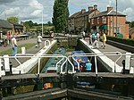
Ashton, West Northamptonshire
Civil parishes in NorthamptonshireNorthamptonshire geography stubsOpenDomesdayUse British English from March 2014Villages in Northamptonshire ... and 1 more
West Northamptonshire District

Ashton is a village in West Northamptonshire about 1 mile (1.6 km) southeast of Roade village close to the Northampton to Milton Keynes A508, ca.3 miles (5 km) south of junction 15 of the M1 motorway, 6 miles (10 km) south of Northampton and 11 miles (18 km) north of Milton Keynes. The population of the civil parish at the 2011 census was 395. The village is about 67 miles (107.8 km) north of London via the M1 junction 15. The West Coast Main Line intersects the village on its eastern side. The villages name means 'At the ash-trees'.
Excerpt from the Wikipedia article Ashton, West Northamptonshire (License: CC BY-SA 3.0, Authors, Images).Ashton, West Northamptonshire
Cooks Close,
Geographical coordinates (GPS) Address Nearby Places Show on map
Geographical coordinates (GPS)
| Latitude | Longitude |
|---|---|
| N 52.1421 ° | E -0.8806 ° |
Address
Cooks Close
Cooks Close
NN7 2JS , Ashton
England, United Kingdom
Open on Google Maps


