Heuvelland

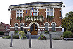
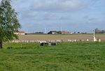
Heuvelland (Dutch pronunciation: [ˈɦøːvəlɑnt] ) is a municipality located in the Belgian province of West Flanders. The municipality comprises the villages of Dranouter, Kemmel, De Klijte, Loker, Nieuwkerke, Westouter, Wijtschate and Wulvergem. Heuvelland is a thinly populated rural municipality, located between the small urban centres of Ypres and Poperinge and the metropolitan area of Kortrijk-Lille along the E17. On 1 January 2006 Heuvelland had a total population of 8,217. The total area is 94.24 km2 which gives a population density of 87 inhabitants per km2. The name heuvelland is Dutch meaning "hill country", as the municipality is characterized by the different hills on its territory.
Excerpt from the Wikipedia article Heuvelland (License: CC BY-SA 3.0, Authors, Images).Heuvelland
Blekerijstraat,
Geographical coordinates (GPS) Address Nearby Places Show on map
Geographical coordinates (GPS)
| Latitude | Longitude |
|---|---|
| N 50.766666666667 ° | E 2.8166666666667 ° |
Address
Blekerijstraat 2
8951
West Flanders, Belgium
Open on Google Maps


