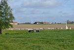
The Gas attacks at Wulverghem (30 April and 17 June 1916) were German cloud gas releases during the First World War on British troops at Wulverghem in the municipality of Heuvelland, near Ypres in the Belgian province of West Flanders. The gas attacks were part of the sporadic fighting between battles in the Ypres Salient on the Western Front. The British Second Army held the ground from Messines Ridge northwards to Steenstraat and the divisions opposite the German XXIII Reserve Corps had received warnings of a gas attack. From 21 to 23 April, British artillery-fire exploded several gas cylinders in the German lines around Spanbroekmolen, which released greenish-yellow clouds. A gas alert was given on 25 April when the wind began to blow from the north-east and routine work was suspended; on 29 April, two German soldiers deserted and warned that an attack was imminent. Just after midnight on 30 April, the German attack began and over no man's land, a gas cloud drifted on the wind into the British defences, then south-west towards Bailleul.
The gas used at Wulverghem was a mixture of chlorine and phosgene, which had been used against British troops on 19 December 1915 in the phosgene attack at Wieltje, north-east of Ypres. This and earlier gas attacks, beginning at the Second Battle of Ypres (21 April – 25 May 1915) had given the British time to replace improvised gas masks with effective mass-produced versions, obtain other anti-gas equipment and to establish anti-gas procedures. Helmets impregnated with chemicals to neutralise chlorine had been issued in several variants, each more effective than the last. By April 1916, British troops had PH helmets and some specialist troops like machine-gunners, were equipped with box respirators. The German gas attack at Wulverghem on 30 April, caused the defenders 562 gas casualties and 89 gas fatalities but German raiding parties, looking for mine entrances to destroy, were repulsed with small-arms and artillery fire. A second attempt by the Germans on 17 June caused about the same number of gas casualties but the British again easily repulsed German patrols.


