Fliegerhorst Vlamertinge
Belgian military aircraft
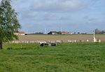
Fliegerhorst Vlamertinge is a former military air base, located 8.4 km east-southeast of Poperinge in West Flanders, Belgium. It was closed in 1945 and is now in agricultural use.
Excerpt from the Wikipedia article Fliegerhorst Vlamertinge (License: CC BY-SA 3.0, Authors).Fliegerhorst Vlamertinge
Zorgvlietstraat,
Geographical coordinates (GPS) Address Nearby Places Show on map
Geographical coordinates (GPS)
| Latitude | Longitude |
|---|---|
| N 50.832777777778 ° | E 2.8236111111111 ° |
Address
Zorgvlietstraat
Zorgvlietstraat
8900 , Dikkebus
West Flanders, Belgium
Open on Google Maps


