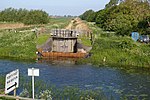
Ouse Washes

Ouse Washes is a linear 2,513.6-hectare (6,211-acre) biological Site of Special Scientific Interest stretching from near St Ives in Cambridgeshire to Downham Market in Norfolk. It is also a Ramsar internationally important wetland site, a Special Protection Area for birds, a Special Area of Conservation and a Nature Conservation Review site, Grade I. An area of 186 hectares (460 acres) between March and Ely is managed by the Wildlife Trust for Bedfordshire, Cambridgeshire and Northamptonshire and another area near Chatteris is managed by the Royal Society for the Protection of Birds. The Wildfowl & Wetlands Trust manages another area near Welney. The site lies between the Old Bedford River in the north-west and the New Bedford River in the south-east. The Washes are a flood storage area and are often under water in the winter. It is internationally significant for wintering and breeding wildfowl and waders, especially teal, pintail, Eurasian wigeon, shoveler, pochard and Bewick's swans. The site also has rich aquatic fauna and flora, and areas of unimproved grassland.
Excerpt from the Wikipedia article Ouse Washes (License: CC BY-SA 3.0, Authors, Images).Ouse Washes
East Cambridgeshire Downham
Geographical coordinates (GPS) Address Nearby Places Show on map
Geographical coordinates (GPS)
| Latitude | Longitude |
|---|---|
| N 52.46 ° | E 0.19 ° |
Address
Byall Fen
CB6 2DR East Cambridgeshire, Downham
England, United Kingdom
Open on Google Maps


