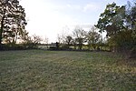
Little Downham

Situated in the east of Cambridgeshire, the village of Little Downham is located just 3 miles (5 km) north of the city of Ely. The Parish of Downham comprises Little Downham and Pymoor. It has an approximate population of 2660 with approximately 35 miles for footpaths around the parish. The population was measured at the 2011 Census as 2,589. It was one of only two sites in Cambridgeshire to be covered by the Survey of English Dialects. In the Domesday Book of 1086 the village is called Duneham. At the time the Fens were mostly flooded, and the village is on a small rise of solid ground (visible today), so there may have been 'dunes' there. In a map from 1648 (above), 'Downham' is shown at the north-west edge of the Isle of Ely, hence its historic name of 'Downham-in-the-Isle'.
Excerpt from the Wikipedia article Little Downham (License: CC BY-SA 3.0, Authors, Images).Little Downham
Tower Road, East Cambridgeshire Downham
Geographical coordinates (GPS) Address Nearby Places Show on map
Geographical coordinates (GPS)
| Latitude | Longitude |
|---|---|
| N 52.433 ° | E 0.233 ° |
Address
Tower Road
Tower Road
CB6 2TD East Cambridgeshire, Downham
England, United Kingdom
Open on Google Maps


