Kingsland Basin
1822 establishments in EnglandCanal basins in England and WalesLondon docksLondon geography stubsRedevelopment projects in London ... and 4 more
Regent's CanalUnited Kingdom canal stubsUse British English from December 2016Vague or ambiguous time from January 2018

Kingsland Basin is a canal basin in the De Beauvoir Town area of the London Borough of Hackney. The basin, which is also known as Kingsland Road Basin, dates from 1822 and is part of the Regents Canal. The area is the site of numerous housing redevelopments.
Excerpt from the Wikipedia article Kingsland Basin (License: CC BY-SA 3.0, Authors, Images).Kingsland Basin
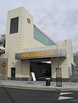
Kingsland Road, London Haggerston (London Borough of Hackney)
Geographical coordinates (GPS) Address Nearby Places Show on map
Geographical coordinates (GPS)
| Latitude | Longitude |
|---|---|
| N 51.537303 ° | E -0.077989 ° |
Address
Benyon Wharf
Kingsland Road 295
E8 4DD London, Haggerston (London Borough of Hackney)
England, United Kingdom
Open on Google Maps


