place

Taverham

AC with 0 elementsBroadlandCivil parishes in NorfolkVillages in Norfolk
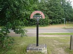
Taverham sign
Taverham sign

Taverham is a village and civil parish in Norfolk, in England. It is approximately 5 miles (8 km) north-west of Norwich. Taverham sits on the River Wensum. Taverham forms part the wider Norwich Built-up area. In 2001, Taverham had a population of 10,233. It has seen recent population growth with the building of Thorpe Marriott, a new residential development that straddles the boundary with the neighbouring village of Drayton. The patron saint of Taverham is St Walstan who according to legend lived and worked in the village in the 11th century. By 2013, the area of Taverham had an approximate population of 14,121.

Excerpt from the Wikipedia article Taverham (License: CC BY-SA 3.0, Authors, Images).

Taverham
Victoria Road, Broadland Taverham

Geographical coordinates (GPS) Address Nearby Places
placeShow on map

Wikipedia: TaverhamContinue reading on Wikipedia

Geographical coordinates (GPS)

Latitude Longitude
N 52.68 ° E 1.2 °
placeShow on map

Address

Victoria Road

Victoria Road
NR8 6NW Broadland, Taverham
England, United Kingdom
mapOpen on Google Maps

Taverham sign
Taverham sign
Share experience

Nearby Places

Ringland, Norfolk
Ringland, Norfolk

Ringland is a village and civil parish in Norfolk, England, and in the valley of the River Wensum, approximately 7 miles (11 km) north-west of Norwich. Parts of the Wensum valley within the parish constitute a Site of Special Scientific Interest. Ringland had a 2011 population of 260,[1] in an area of 1.95 square miles (5.1 km2). The villages name means 'land of Rymi's people'.The parish church of St Peter's has a 13th-century tower and a 14th-15th century nave and chancel. The higher terrain of Ringland Hills lies within the parish to the east of the village and north of the Wensum, and are thought to be a glacial terminal moraine, much the same as Cromer ridge. The soil here is sandy with flint pebbles. Painter Alfred Munnings produced a work entitled Ponies on Ringland Hills.The village has extensive common land: a lower area on the river Wensum and an upper area with the remains of a Beaker pit in the direction of Weston Longville. The river was originally crossed by a wooden footbridge (and a ford for horse-drawn traffic). This was replaced in the 1920s with a concrete structure which remains today. Rare concrete 'tank traps' from World War II still exist by the banks of the Wensum. The village originally had two public houses, the King of Prussia and the Swan Inn. The King of Prussia was renamed 'The Union Jack' during the Second World War, and finally closed in the 1960s. The Swan remains to this day; attached is a restaurant run by the owners.