Costessey

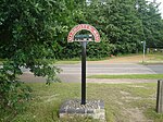
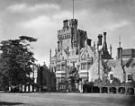
Costessey ( (listen) KOSS-ee) is a civil parish centred 4 miles (6.4 km) WNW of Norwich in Norfolk, England. Three centres of population exist: the long-established town/village of Costessey (now commonly Old Costessey) (2011 population 7,265); New Costessey of simlar population, incepted in the first half of the 20th century, a long network of generally residential roads north of Dereham Road, contiguous with three smaller western suburbs of the county town (city); and Queens Hill which is green-buffered and which has a small country park, mature woodland and a large golf course adjoining. The parts named Old and New are separated by the Tud, adjoining fields and by a retail/business park in the west, a divide of about 2 miles (3.2 km). Old Costessey's northern limit is with Taverham, Drayton and Hellesdon, this follows the course of the wider river Wensum. Costessey constitutes the most northern reaches of the predominantly rural South Norfolk District; Costessey is its second-most populous place as is eclipsed by Wymondham. The usual resident population of the civil parish as at 2011 was returned as 12,463.
Excerpt from the Wikipedia article Costessey (License: CC BY-SA 3.0, Authors, Images).Costessey
Hinshalwood Way, South Norfolk
Geographical coordinates (GPS) Address Nearby Places Show on map
Geographical coordinates (GPS)
| Latitude | Longitude |
|---|---|
| N 52.66023 ° | E 1.21614 ° |
Address
Hinshalwood Way
Hinshalwood Way
NR8 5BW South Norfolk
England, United Kingdom
Open on Google Maps


