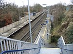
Woolage Village
Kent geography stubsMining communities in EnglandVillages in Kent

Woolage Village is a former mining village situated midway between Canterbury and Dover in the English county of Kent. It is 1 mile (1.6 km) to the east of the A2 road. Together with Womenswold and Woolage Green, it forms Womenswold parish. It consists of approximately 52 semi-detached houses built in 1912, to house miners and their families working at the nearby Snowdown Colliery. The village shop and post office was shut in the 1990s and converted to a dwelling.
Excerpt from the Wikipedia article Woolage Village (License: CC BY-SA 3.0, Authors, Images).Woolage Village
The Place, Canterbury
Geographical coordinates (GPS) Address Nearby Places Show on map
Geographical coordinates (GPS)
| Latitude | Longitude |
|---|---|
| N 51.206 ° | E 1.199 ° |
Address
The Place
The Place
CT4 6SL Canterbury
England, United Kingdom
Open on Google Maps


