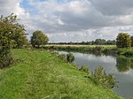
Shifford Lock

Shifford Lock is a lock on the River Thames in England. It is in the centre of a triangle formed by the small villages of Shifford, Duxford and Chimney in Oxfordshire. It is at the start of a navigation cut built with the lock by the Thames Conservancy in 1898. This was the only new lock built on the non-tidal Thames in the era of falling revenue after the Thames Conservancy took over responsibilities of the Thames Navigation Commission. It replaced a flash lock in a weir about 3⁄4 mile (1.2 km) downstream. There is a small weir beside the lock and a larger weir on the old course of the river upstream at the top of the lock cut.
Excerpt from the Wikipedia article Shifford Lock (License: CC BY-SA 3.0, Authors, Images).Shifford Lock
Shifford Cut Footbridge, West Oxfordshire Aston, Cote, Shifford and Chimney
Geographical coordinates (GPS) Address Website Nearby Places Show on map
Geographical coordinates (GPS)
| Latitude | Longitude |
|---|---|
| N 51.70652 ° | E -1.46595 ° |
Address
Chimney Meadows
Shifford Cut Footbridge
OX18 2EJ West Oxfordshire, Aston, Cote, Shifford and Chimney
England, United Kingdom
Open on Google Maps


