Longworth
Civil parishes in OxfordshireUse British English from August 2015Villages in Oxfordshire

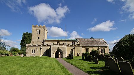
Longworth is a village and civil parish in the Vale of White Horse, England. The 1974 boundary changes transferred it from Berkshire to Oxfordshire. The village lies between Faringdon, 7 miles (11 km) to its west, and Oxford, 9 miles (14 km) to the north-east. The 2011 Census recorded a population of 566, which was estimated at 570 in 2019. The parish is bounded by the River Thames to the north, the A420 road to the south, and field boundaries to the east and west. The land slopes from the A420 to the river, except at Harrowdown Hill near the north-east corner of the parish, which has a summit of 325 feet (99 m).
Excerpt from the Wikipedia article Longworth (License: CC BY-SA 3.0, Authors, Images).Longworth
Tuck's Lane, Vale of White Horse
Geographical coordinates (GPS) Address Nearby Places Show on map
Geographical coordinates (GPS)
| Latitude | Longitude |
|---|---|
| N 51.697019 ° | E -1.4376 ° |
Address
Tuck's Lane
Tuck's Lane
OX13 5ES Vale of White Horse
England, United Kingdom
Open on Google Maps


