Duxford, Oxfordshire
Use British English from August 2015Villages in Oxfordshire

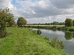
Duxford is a hamlet in the civil parish of Hinton Waldrist 5.5 miles (9 km) northeast of Faringdon. It was part of Berkshire until the 1974 boundary changes transferred it to Oxfordshire. It is on the south bank of the Thames, across which is its eponymous ford leading to a lock island which has a footbridge to Chimney on the north bank. This is the only ford today along the river, excluding along its intermittent brook at the source village, Kemble, Gloucestershire however the ford only crosses part of the river.
Excerpt from the Wikipedia article Duxford, Oxfordshire (License: CC BY-SA 3.0, Authors, Images).Duxford, Oxfordshire
Vale of White Horse
Geographical coordinates (GPS) Address Nearby Places Show on map
Geographical coordinates (GPS)
| Latitude | Longitude |
|---|---|
| N 51.694 ° | E -1.473 ° |
Address
SN7 8SA Vale of White Horse
England, United Kingdom
Open on Google Maps


