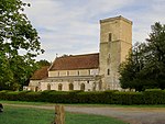
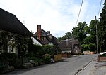
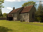
Netheravon
Civil parishes in WiltshireEngvarB from November 2015OpenDomesdayVillages in Wiltshire

Netheravon is a village and civil parish on the River Avon and A345 road, about 4 miles (6.4 km) north of the town of Amesbury in Wiltshire, South West England. It is within Salisbury Plain. The village is on the right (west) bank of the Avon, opposite Fittleton. The parish extends west onto Netheravon Down.
Excerpt from the Wikipedia article Netheravon (License: CC BY-SA 3.0, Authors, Images).Netheravon
Old Brewery Lane,
Geographical coordinates (GPS) Address Nearby Places Show on map
Geographical coordinates (GPS)
| Latitude | Longitude |
|---|---|
| N 51.237 ° | E -1.79 ° |
Address
Old Brewery Lane
Old Brewery Lane
SP4 9PQ , Netheravon
England, United Kingdom
Open on Google Maps


