A345 road
Geographic coordinate listsInfobox road instances in EnglandInfobox road maps tracking categoryLists of coordinatesRoads in England ... and 2 more
Roads in WiltshireUse British English from February 2013

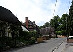
The A345 is a secondary A road in Wiltshire, England running from Salisbury to Marlborough and the A4. The road is a main south–north link across Salisbury Plain, which is renowned for its rich archaeology, and passes many ancient points of interest along its way.
Excerpt from the Wikipedia article A345 road (License: CC BY-SA 3.0, Authors, Images).A345 road
A345,
Geographical coordinates (GPS) Address Nearby Places Show on map
Geographical coordinates (GPS)
| Latitude | Longitude |
|---|---|
| N 51.2545 ° | E -1.7992 ° |
Address
A345
SN9 6DH , Enford
England, United Kingdom
Open on Google Maps


