Albrandswaard

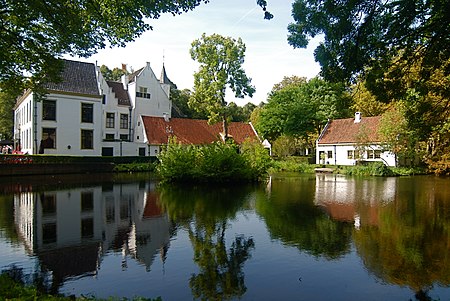
Albrandswaard (Dutch: [ˌɑlbrɑntsˈʋaːrt] (listen)) is a municipality in the western Netherlands, in the province of South Holland. The municipality had a population of 25,271 as of 2019, and covers an area of 23.76 km2 (9.17 sq mi) of which 2.07 km2 (0.80 sq mi) is water. The municipality of Albrandswaard consists of the village of Poortugaal in the west and Rhoon in the east. They were separate municipalities until 1985. The name was taken from the historic municipality of Albrandswaard en Kijvelanden, which existed until 1842, when it joined Poortugaal. Albrandswaard actually is a polder located between Rhoon and Poortugaal. Both villages have a metro station on Rotterdam Metro line D (Poortugaal station and Rhoon station), which connect them to Rotterdam and to the main railway network from Rotterdam Centraal in the east, and to Hoogvliet and Spijkenisse in the west.
Excerpt from the Wikipedia article Albrandswaard (License: CC BY-SA 3.0, Authors, Images).Albrandswaard
Slotvalkensteinsedijk, Albrandswaard
Geographical coordinates (GPS) Address Nearby Places Show on map
Geographical coordinates (GPS)
| Latitude | Longitude |
|---|---|
| N 51.866666666667 ° | E 4.4 ° |
Address
Slotvalkensteinsedijk 19
3176 PP Albrandswaard
South Holland, Netherlands
Open on Google Maps


