place

Elkington, Northamptonshire

Civil parishes in NorthamptonshireDeserted medieval villages in NorthamptonshireNorthamptonshire geography stubsWest Northamptonshire District
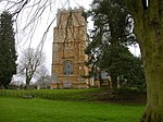
Elkington geograph.org.uk 198279

Elkington is a hamlet and civil parish in the West Northamptonshire in England. The villages name means 'Elta's hill' or perhaps, less likely, 'swan hill'.The village was described as Elkynton and other variants in 1377, having 30 taxpayers over the age of 14. However, in 1412 the village is described as destitute of inhabitants save the seven who were servitors at Pipewell Abbey due to a pestilence believed to be the plague. Today there are no houses left in the village except a single remaining farm. Outlines of the village street can be seen from a survey taken from the air. The site of the former settlement is close to bridge 28 on the Leicester section of the Grand Union Canal.It is from this village that many of the Elkington branches of that surname are supposed to have been descended; mostly the Leicestershire and Oxfordshire/Warwickshire branches come from that region.

Excerpt from the Wikipedia article Elkington, Northamptonshire (License: CC BY-SA 3.0, Authors, Images).

Elkington, Northamptonshire

Geographical coordinates (GPS) Address Nearby Places
placeShow on map

Wikipedia: Elkington, NorthamptonshireContinue reading on Wikipedia

Geographical coordinates (GPS)

Latitude Longitude
N 52.38298 ° E -1.08318 °
placeShow on map

Address


NN6 6NH
England, United Kingdom
mapOpen on Google Maps

Elkington geograph.org.uk 198279
Share experience

Nearby Places

Stanford Reservoir
Stanford Reservoir

Stanford Reservoir is a drinking water reservoir on the River Avon, England. It lies on the county boundary between Leicestershire and Northamptonshire near the village of Stanford-on-Avon. The reservoir was built between 1928 and 1930 by Rugby Urban District Council in order to supply the nearby town of Rugby with drinking water. It was created by building an earth and clay dam across the line of the original river, and flooding a small valley between the villages of South Kilworth and Stanford. At its north-eastern extremity, the river enters the reservoir via a settling pond and leaves at the other end via a spillway and a specially constructed channel below the dam. There is a by-pass channel along the northern perimeter, controlled by sluice gates, which allows the water level in the reservoir to be regulated and reduced for repair and maintenance works, and for the flow of water in the river below the dam to be maintained.The reservoir was enlarged between 1958 and 1959, and now covers an area of approximately 58 hectares (140 acres). The average width of the reservoir is around 300 metres (980 ft) and the overall length is approximately 1.8 kilometres (1.1 mi). Following a 1 in 100 year flood risk assessment, the spillway was substantially reconstructed in 2017. The reservoir is still used for its original role, but is now a top-up for the much larger Draycote Water reservoir, some 15 miles (24 km) to the south-west which was created in the 1960s. It is now owned by the company Severn Trent Water.The site is considered important for bird species including tufted duck, wigeon, pochard and shoveller and five species of bats. The Wildlife Trust for Bedfordshire, Cambridgeshire and Northamptonshire have a management agreement to look after wildlife aspects. The reservoir is open to public visits, but requires a permit.