West Haddon
Civil parishes in NorthamptonshireUse British English from March 2014Villages in NorthamptonshireWest Northamptonshire District

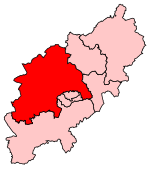
West Haddon is a village in West Northamptonshire, England about 11 miles (18 km) north-west of Northampton and 7 miles (11 km) east of Rugby and just off the A428 road which by-passes the village. The population of civil parish was 1,718 at the 2011 Census. The villages of West Haddon and Crick were by-passed by the A428 main road from Rugby to Northampton when the Daventry International Rail Freight Terminal (DIRFT) was built in 1996 near junction 18 of the M1 Motorway, 3 miles (4.8 km) west of the village.
Excerpt from the Wikipedia article West Haddon (License: CC BY-SA 3.0, Authors, Images).West Haddon
Station Road,
Geographical coordinates (GPS) Address Nearby Places Show on map
Geographical coordinates (GPS)
| Latitude | Longitude |
|---|---|
| N 52.34 ° | E -1.077 ° |
Address
Station Road 1
NN6 7BS , West Haddon
England, United Kingdom
Open on Google Maps


