place

Shuckburgh Hall

Country houses in WarwickshireGrade II* listed buildings in WarwickshireGrade II* listed housesItalianate architecture in England
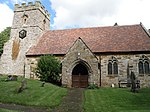
Upper Shuckburgh Hall geograph.org.uk 1257345

Shuckburgh Hall is a privately owned country house mansion at Lower Shuckburgh, Warwickshire, near to Daventry in Northamptonshire. The estate has been the home of the Shuckburgh family since the 12th century. The house, which was granted Grade II* listed building status in January 1952, is not generally open to the public.The house has its origins in the 14th and 15th centuries but has been much altered and extended over many years. The main front, designed by Henry Edward Kendall Jr. in an Italianate style, was built on to the old house in 1844.Sir George Shuckburgh-Evelyn (1751–1804) placed an order with Jesse Ramsden for a telescope in 1781, and it was delivered ten years later. The telescope, known as the Shuckburgh telescope, was installed in his observatory at the hall and was moved after his death to the Royal Observatory, Greenwich in London by 1811. It was used there for over a century before being moved to the Science Museum, London, in 1927.He also ordered a clock from John Arnold & Son to use with the telescope at this observatory.

Excerpt from the Wikipedia article Shuckburgh Hall (License: CC BY-SA 3.0, Authors, Images).

Shuckburgh Hall
Park Hill, Stratford-on-Avon Upper and Lower Shuckburgh CP

Geographical coordinates (GPS) Address Nearby Places
placeShow on map

Wikipedia: Shuckburgh HallContinue reading on Wikipedia

Geographical coordinates (GPS)

Latitude Longitude
N 52.2526 ° E -1.2732 °
placeShow on map

Address

Church of Saint John the Baptist

Park Hill
NN11 6DU Stratford-on-Avon, Upper and Lower Shuckburgh CP
England, United Kingdom
mapOpen on Google Maps

Upper Shuckburgh Hall geograph.org.uk 1257345
Share experience

Nearby Places

Flecknoe
Flecknoe

Flecknoe is a village in the Rugby district of Warwickshire, England, one mile west of the border with Northamptonshire. The village is the largest settlement within the civil parish of Wolfhampcote, and has a population of around 200. The village was mentioned in the Domesday Book as Flachenho, probably meaning "Flecca's hill". The village is shown as Fleckno on the Christopher Saxton map of 1637. Flecknoe is quite an isolated village, it is located on a hill called Bush Hill, one mile north of the nearest main road (the A425 road Southam - Daventry road) and is connected only by narrow lanes. Flecknoe has a small church, dedicated to St. Mark, which was built in 1891. An older chapel in the village dating from 1837 is now a private house. The village formerly had a school, which is now the village hall. On the outskirts of the village is a derelict brick building which is attributed to be the remains of a Second World War camp. The village also has an Edwardian pub called the Old Olive Bush.The Grand Union Canal runs in the plain to the north of the village, which also contains the remain of the former Weedon to Leamington railway line. Flecknoe once had a railway station on this line. The station was over a mile north of the village and effectively in the middle of nowhere, consequently it was an early victim of British Railways' closure programme, the last passenger train running on 3 November 1952. However, the line survived carrying freight until 2 December 1963. To the east of the village are the remains of the former Great Central Main Line. Around half a mile to the north of Flecknoe is the tiny hamlet of Nethercote.