Whilton

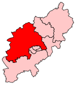
Whilton is a village and a civil parish in the English county of Northamptonshire. The population (including Slapton) at the 2011 Census was 271. The village is in West Northamptonshire. Whilton is 75 miles (121 km) northwest of London, 9+3⁄4 miles (15.7 km) west of Northampton and 15+1⁄2 miles (24.9 km) southeast of Rugby. The village lies 4+1⁄2 miles (7.2 km) east of the nearest town of Daventry. The nearest railway station is at Long Buckby for the Northampton loop of the West Coast Main Line which runs between Rugby, Northampton and London. The nearest airport is Birmingham Airport. Whilton gives its name to the nearby Whilton Locks and Whilton Marina on the Grand Union Canal.
Excerpt from the Wikipedia article Whilton (License: CC BY-SA 3.0, Authors, Images).Whilton
Wadd Close Lane,
Geographical coordinates (GPS) Address Nearby Places Show on map
Geographical coordinates (GPS)
| Latitude | Longitude |
|---|---|
| N 52.27737 ° | E -1.06791 ° |
Address
Wadd Close Lane
Wadd Close Lane
NN11 2SJ , Whilton
England, United Kingdom
Open on Google Maps


