Bannaventa
Archaeological sites in NorthamptonshireEngvarB from February 2018Former populated places in NorthamptonshireHistory of NorthamptonshireRoman towns and cities in England ... and 2 more
Structures on the Heritage at Risk registerWest Northamptonshire District

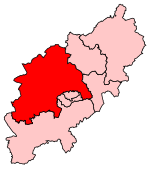
Bannaventa or Benaventa was a Romano-British fortified town which was on the Roman road later called Watling Street, which today is here, as in most places, the A5 road. Bannaventa straddles the boundaries of Norton and Whilton, Northamptonshire, England, villages highly clustered 1 kilometre (0.62 mi) and double that away, respectively.
Excerpt from the Wikipedia article Bannaventa (License: CC BY-SA 3.0, Authors, Images).Bannaventa
Roman Road,
Geographical coordinates (GPS) Address Nearby Places Show on map
Geographical coordinates (GPS)
| Latitude | Longitude |
|---|---|
| N 52.2753 ° | E -1.1022 ° |
Address
Roman Road
Roman Road
NN11 2NH , Whilton
England, United Kingdom
Open on Google Maps


