Upwaltham

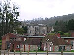
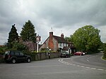
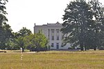
Upwaltham is a scattered settlement and civil parish in the South Downs, in the District of Chichester of West Sussex, England. It surrounds a parish church, which is about 5 miles (8 km) south-southwest of Petworth on the A285 road. The parish is about 2+3⁄4 miles (4.4 km) long north – south, up to 1+1⁄4 miles (2 km) wide east – west and has an area of 494 hectares (1,220 acres). The northern part of the parish includes part of North Down, a hill 830 feet (253 m) high. The 2001 Census recorded a parish population of 25 people, living in 10 households. The scattered settlement is in a dry valley. Around the parish church are two farmsteads and two cottages. The barns of one of the farmsteads, Upwaltham House Farm, are now a conference and wedding venue.About 1 mile (1.6 km) south of the church are a few houses at Benges, where the A285 to Chichester leaves the valley. From Benges the parish extends south as far as Jackdine Farm.
Excerpt from the Wikipedia article Upwaltham (License: CC BY-SA 3.0, Authors, Images).Upwaltham
A285, Chichester
Geographical coordinates (GPS) Address Nearby Places Show on map
Geographical coordinates (GPS)
| Latitude | Longitude |
|---|---|
| N 50.91526 ° | E -0.66016 ° |
Address
A285
GU28 0LU Chichester
England, United Kingdom
Open on Google Maps


