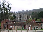
Graffham
Chichester DistrictVillages in West Sussex

Graffham is a village, Anglican parish and civil parish in West Sussex, England, situated on the northern escarpment of the South Downs within the South Downs National Park. The civil parish is made up of the village of Graffham, part of the hamlet of Selham, and South Ambersham. It forms part of the Bury Ward for the purposes of electing a Councillor to Chichester District Council.
Excerpt from the Wikipedia article Graffham (License: CC BY-SA 3.0, Authors, Images).Graffham
Woodcote Lane, Chichester Graffham
Geographical coordinates (GPS) Address Nearby Places Show on map
Geographical coordinates (GPS)
| Latitude | Longitude |
|---|---|
| N 50.94989 ° | E -0.68077 ° |
Address
Woodcote Lane
Woodcote Lane
GU28 0NZ Chichester, Graffham
England, United Kingdom
Open on Google Maps


