Charleston, Staten Island
Neighborhoods in Staten Island

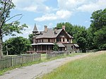
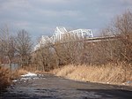
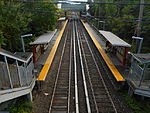
Charleston is a neighborhood, or section, of New York City's borough of Staten Island. It is located on the island's South Shore, with Tottenville to the south, Pleasant Plains to the East, Rossville to the north, and the Arthur Kill to the west. The neighborhood is represented in the New York City Council by Joe Borelli and in the New York State Senate by Andrew Lanza.
Excerpt from the Wikipedia article Charleston, Staten Island (License: CC BY-SA 3.0, Authors, Images).Charleston, Staten Island
Arthur Kill Road, New York Staten Island
Geographical coordinates (GPS) Address Nearby Places Show on map
Geographical coordinates (GPS)
| Latitude | Longitude |
|---|---|
| N 40.536944444444 ° | E -74.237222222222 ° |
Address
Arthur Kill Road 4314
10309 New York, Staten Island
New York, United States
Open on Google Maps


